Showing posts with label wtmc. Show all posts

Monday, August 21, 2017

The weekend with work skiing

Hi,

What a great weekend.  Even if I did miss Toby for great portions of it.  Friday lunchtime saw Sreejith follow through on his commitment to the spin instructor to help take the class.  He was up front and centre and did soooooo well.  I couldn't have kept up that pace.  And he matched the instructor like they planned it!

Chenda and I left work and got our car out of Clifton Terrace and headed to the train station.  We put our gear in the van and headed to J'ville to swap to the van and collect the others.  Prasad and his family were in the van, along with Ariel and Gareth.

We had a slow drive up.  1 hour to Paekakariki.  Phew!  But we were in the lodge by 11pm.  After staying up to help Sreejith come up, it was 1am by the time I fell into bed.  And possibly drinking three cans of V in the evening wasn't my best idea.  I had to read for an hour before I fell asleep.

Up fairly early and away skiing.  I found Rex and Matt and skied with them for an hour before sticking to Tennants Valley for a while.  No crowds meant I could ski happily on the lower mountain and there was lovely snow.  But I headed up to the new Delta chair and enjoyed the Turtle run for the rest of the day.


Squinting against the sunshine!

Selfie having fun in the whiteout

Sreejith getting ready

And...with Scotty and they co-ordinate like they planned it!


By 2pm I was exhausted - never stopping for lunch or anything.  Wandered back to the lodge and read and maybe fell asleep for a bit.

Dinner was scrumptious.  Justin's wife Christelle and her friend cooked tea and Justin was the sous chef.  Roast vege, chicken and broccoli in mountains of cheese sauce with rice.  Mmmmm.

We headed down to Tussock at 7.30pm to meet the other work colleagues.  Sreejith has a 4WD Land Rover and it made light work of the thick snow.  But by the time we got to the pub, my workmates were leaving.

We headed back to their lodge and drank beer (well, some of us did), and played games.  Codenames is a new game I quite enjoyed.  I drove back up the hill and had fun trying to park in carpark 1 before giving up and going to carpark 2.

Another late night saw a late start to my ski day.  10am by the time I got my first run in.  But I headed up to Delta chair as soon as I could.  The sun came through a wee bit for my first few runs and the powder was fantastic!  Had a ball.

Came down early to help Mike with the packing up.  He had done pretty much everything so I got a well wanted shower.  It was slow getting everyone in the van and was 3.30pm by the time we left.  Picked up Chenda from the F&B lodge and headed home.

Prasad's wee daughter was car sick a lot.  Poor wee thing.  But she would puke into a bag her dad held, and then be chirpy happy enough.  Back home and I picked up groceries before collecting Mike from Lower Hutt where he had dropped off the van.

Awesome weekend!  Can't wait for more skiing now.  Better wash my gear - I have another trip this coming weekend to Mt Hutt with Andrew.  Woot!

Love,
Angela

Monday, September 7, 2015

The weekend away skiing

Hi,

We've decided to postpone Fathers Day because we were up at the mountain for it.  But I think Mike had a good time, nevertheless.

Friday we left relatively late for a ski weekend trip.  Mike came and collected me and Toby from home on the way out.  I say next to some Chinese students and chatted away to them for most of the trip up.  Lu, Ming and Eric.  Toby was in front of me and watched a movie on the laptop until it ran out of battery.

We had dinner in Levin and then drove up.  We got out of the van just after Scoria Flat on the way up the hill and Mike realised why the steering was getting twitchy.  It was sheet black ice on the road.  We put the chains on and then got up without any hassles.  We dumped all the gear close by and Toby led newbies up the hill to the lodge.  Mike and I went to park the van and Mike was so worried now the van was lighter and the ice was slicker.  We parked when the van decided to stop slipping.  Yikes!

Next morning was a stunning morning.  No clouds.  No wind.  Beautiful snow.  Off piste was icy - new snow during the week has frozen.  It looked perfect, but it was ice.  But the trails were perfect.

I skied by myself all day.  First on the Waterfall T and then when the far west opened, I scooted over there and stayed there all day.

Selfie on Waterfall T

Selfie on the west quad runs

Clagged in for 2 minutes

Had a great time, although I wished I was skiing with someone.  The snow was perfect and there was no wind.  The singles queue at the west quad chair went fairly fast.  I tracked my skiing for two runs and found I hit a top speed of 43 km/hr (it wasn't very steep where I was skiing) and my run was 1 km long and took me three minutes.  Oh!  I was astonished that it only took me three minutes to get down my run.  It made the 15 mins in the queue look like crazy behaviour.  I need a mid week ski holiday!


Saturday night entertainment


Back to the lodge around 4pm and dinner was ready.  Yummy lasagne.  What a treat!  And then I wasn't far off bed really.  Chatted to Sarah a bit.  Ilske worked like a crazy woman in the kitchen tidying up and was getting a bit sick and went to bed.

Next morning was Father's Day and the Chinese contingent decided to make a special breakfast for Mike and the other fathers.  They were up all hours making dumplings.  Yum!

Happy Fathers Day

After breakfast (I ate so much) we tidied up, packed up the van and left at about 11.45am.  It was snowing quite hard by then and they had closed the mountain.

Driving down the mountain in a blizzard


The drive home was nice and fast and we were home in good time to do the chores for the week.  Yay for chores.  Not!

Right.  Time to start my day.  Busy at work today.  A new team member is starting.

Have an awesome week.

Love,
Angela

Thursday, January 1, 2015

New Years was cancelled this year

One thing I've kept up since high school is having New Years in a different place every year, and being there to see the new year in.

Neither happened this year.  I'm asserting that there was no New Years in 2015.  If people can seamlessly move from being aged 39 to aged 31, why can't I do the same with New Years holidays?

It all started with my organising Open Lodge again this year.  The theory is that if we have a Lodge Leader at the WTMC lodge, then people can just turn up when they feel like it with no booking no hassle, which means summer use and PROFIT.  In practice you also need a Lodge Leader to be there.  Easier said than done.  A hole turned up on Dec 31, which was the most popular day of the year last year, so I felt obliged to fill it.  Angela and Toby were off to Sunshine Coast, I stayed behind to sort my Mum out, but she headed back to Dunedin early leaving me at a loose end.  So north I headed to provide cover and see the new year in.

I needn't have bothered.  In a delight of how sample sizes of one are not great for prediction, we had a total of six people in the lodge.  I got to hear how the club is run completely wrong and should be catering for people who were active members in the 1980s and refuse to use the internet and use club facilities regularly every 5 years, rather than being run for active members in the 2010s who actually go tramping, come to club nights and offer their services to make the club work.

Then somewhat bafflingly, everyone went to bed at 9pm.  I now had limited options.  I could sit up for three hours, staring at the walls with my no-mates just to be awake at 12am.  I could walk through the murky, swirling mist and soaking rain to my car, and drive down to the Tussock Pub to drink ginger beer, pretend I knew people, and half heartedly cheer as the clock ran over.  Or I could go to bed.

I chose the latter.  Far as I'm concerned I had no conscious sight of any time between 31/12/2014 21:00 and 1/1/2015 7:00 so those times did not happen.

Sunday, March 30, 2014

Mid Goulter (very steep)

Punters: Mike Gilbert, Helen Bennett, Jenn Zhu, Clare Denny, Edd Lucas


"Hmm, maybe my hatchback wouldn't make it here after all," I finally admitted, at about a quarter to midnight.  Whilst it's a 'gravel road' on the map, the road to Lake Chalice is a lot more like a goat track than a road.  It's narrow, steep, winding and rough.  For once I was grateful to be in a big van with the weight of many punters and their packs holding the back wheels firmly onto the road.

It had already been a long day and a long night.  My job was to collect the vans; a minor crisis at work at just the wrong time meant I was late and rushed, but we all made it onto the ferry in good time.  As we sailed south, we three leaders worked out the logistics of dropoff and pickup.  Emily's trip was straightforward; she was heading to Lake Chalice, then returning to Lake Chalice.  Katy needed a dropoff at some random road-end on the way, then pickup from another random road-end.  I was heading to Lake Chalice but needed someone to collect my group to save an interminable walk down a road that may be gravel, might be 4WD, could be navigable in a van...

So some 8 hours after we started our journey, the Lake Chalice car park suddenly appeared through the darkness.  We unloaded and headed off in the dark to Lake Chalice Hut, which we were reliably informed was somewhere down the track.  It was a beautiful night and perfect conditions for a bit of night walking.  Soon we found that our informants were correct - just 30 min down an easy track we found a spacious, tidy hut.  Emily and her group turned up about half an hour later - this was Emily's first full trip driving the van and she sure picked a tough trip for it!


We all fitted just nicely into the hut, since two of us decided it was such a nice night that sleeping outside was the best thing for it.  The new day dawned fine and crisp, but we were all flavours of Easy trampers so there was no hurry.  After a suitably relaxed beginning to the day, we set off on our respective journeys. Emily's group were daywalking up Old Man ridge, to the north.  We were loping southwest down the valley to Mid Goulter Hut, about 5 DOC hours away; then heading back to the lake chalice car park on the Sunday by climbing out of the valley and returning along the ridgeline. The track in looked really gorgeous on the map, following the shores of Lake Chalice itself and then down beside the Goulter River. But alas, this was somewhat deceiving. The lakeshore and river were steepsided, so the track followed the terraces and spurs a short distance from the water. Still very pleasant but lake- and riverside, not so much. Soon we arrived at the head of the lake, where a short path took us down to the river fan that fed into the lake.  Beautiful it was too.  Next time I'll walk down the river fan and pick the track up at the lake head. 


After stops for photos we carried on down the meandering track. Up and down, side to side we went, and this is where we discovered what the difference is between the long dashed lines and the short dashed lines on the topo map. This was a short-dashed-line route, which was new territory for some of our group! Instead of a smooth gravel track we had a rooty, bumpy, sloping path. So sloping that our left legs were much more tired than our right legs by the end of the day! Water ran a little low for some as we saw the Goulter river much less often than we expected.  Still, the track was quite lovely, wending its way through some trees, then gaining a little height in places to change ecosystems into... some other sorts of trees.  (Where was Illona when you needed her?!).  The weather was superb as it always is in Nelson-Malborough.


One thing about following a river is that there aren't that many bearings to really know how far it is to go. The track wended and wound up and down spurs and gullies and over side creeks... it seemed never ending. But sure enough, in late afternoon a big sign welcoming us to Mid Goulter loomed at us, to the relief of many tired left legs. 

Mid Goulter is a funny sort of hut. Like Lake Chalice hut it's an 8-bunk, but unlike Lake Chalice it is small and poky, and has a dearth of windows.  Still, it's relatively modern, warm and weather tight, and has a delightful history of being nurtured by a couple of old guys over the years who at one point even winched it up into a sunnier spot and rotated it 90 degrees to give it a better outlook. But our little group of 5 were a tight fit, and we had to carefully choreograph moving about inside.

Dinner was cooked on Jenn's fantastic JetBoil. I am now sold on Jetboil. The inner German in me is deeply satisfied at its perfect, efficient design, optimised for boiling water with its integrated, neoprene-wrapped 1L container. However my stove broke when I tried to use it, so we had to press the JetBoil into service doing unnatural things such as cooking a billy full of stew. With a bit of balancing and jury rigging we fashioned a tripod for it, and though the JetBoil Engineering team would be crying and knashing their teeth at the chaotic inefficiency of it all, it did a fantastic job at heating the contents of a 30 year old, well panelbeaten WTMC billy as well.

The hut water supply was the nearby Goulter river, and the sign in the hut sternly warned us to BOIL (for 3 minutes) OR STERILISE the contents of the river before daring to consume it. Most of us respected this but this river is one of the clearest, crispest and most beautiful I've seen, especially outside the hut - bank to bank, completely clear and transparent and flowing languidly.  I took my chances. As did Helen, who declared that her time living on a farm in the Waikato had hardened her stomach to anything.

Next day we were off relatively early for an EM group - there was a ferry leaving and we didn't want to miss it. And we knew that the day started with an uphill slog. Ominously, the signpost pointing us up the hill had no estimated time - either they didn't want to discourage us, or it all depended on whether or not you even made it up the hill! But there was nothing for it but to set off. Clare had damaged her ankle on the lopsided route in, so we split into two parties - Jenn, Edd and Helen heading off first, followed by Clare and I.


And steadily uphill it certainly was. Perversely I actually quite like steep uphill; if you've got to get to the top of a hill, then let me rip the bandaid off and slog up there quickly, rather than interminably climb slowly for hours. Well - rip the bandaid off this certainly did.  Up and up we climbed, through lowland forest giving way to scrub, in turn giving way to alpine plants and bare rock and scree. With a bit of scrambling and 3 points of contact climbing we were relieved to see Edd coming back to report we were nearly there. We traversed across the face of the tallest peak, glad we didn't have to summit it - turned out that Helen and Jenn had in fact missed the turn and had ended up at the top! The view was certainly worth it though.


Suddenly the track jarringly ended on a gravel road - and surreally, an older couple were there walking their dog. We said hello and they reported that the road end was just 15 min back down the road.  Joy! After a bit of a rest and a bite to eat, we set off again. Sure enough there was the road end and (I still can't work out how they did this) there were the dog walkers, back at their van. Wonderfully, they had a big jerry can of water that they were happy to share with us!


There's nothing fun about walking down a gravel road, even one as picturesque as this one. So we were ecstatic to see a familiar looking van appear over the rise as we walked. Thanks, Tracey and Joe! We were wondering if the van would make it, because on the map the road changes from 'gravel' to '4wd only' after lake chalice. But it's actually in better nick past the lake chalice car park - if you made it that far then going on is no worries at all.


We were done! After an uneventful drive back to Picton we met the other van at the Toot and Whistle and relaxed and swapped stories on the ferry. The Richmond Ranges are now near the top of my favourite places to go. This is definitely not the last time I'm going to stay in Lake Chalice hut, that's for sure.

Friday, January 3, 2014

The three days off for New Years

Hi,

Well, the weather is still not co-operating with summer.  It is warm, but so windy today.  Windy enough to rival anything the equinoxes throw at us.  So windy I took the bus into work today.  That's how windy it is!

I had Tuesday off and Mike and I drove up to Ruapehu.  He had punters to collect, so I went in the wee green car with Toby.  He let me have the roof down in return for me listening to some of his music.  Seemed like a fair deal, although after the fifth repeat of "I want a portal gun, portal, portal, portal gun" I was beginning to rethink.  Hahahah.  But fortunately he likes most of my music so we were all good.

Mike was running around like a mad thing because loads more people arrived than he anticipated.  Toby and I read in our bunkroom until close to midnight when we wandered out to the common room.  We saw in the New Year and not too soon after that, both of us collapsed in bed.

The carpark - without any snow!

Toby outside the lodge

We went up to Knoll Ridge cafe on the chairlift.  Toby and I got a discount due to our season passes.  Mike has no season pass, so he paid full price.  We were lucky to have Mike with us, as he got back from a day walk just as we bought our tickets.  Perfect timing!

Up at Knoll Ridge cafe - the Pinnacles with no snow behind Mike

We went up with Susan and Erich and their three children.  Toby loved being with them!  They are 1, 3 and 5 years old.  So Toby kept them amused a lot of the time.  I think Susan and Erich were grateful for a bit of a distraction.
My special needs boy, and Ngauruhoe behind us

Toby thinks it's funny to make faces at the camera now.  You should see the photos I didn't put on here.  He's crazy!

Selfie - and you can see Mike and Toby in the chairlift behind me!

The following day we went for a walk from behind the Chateau to Taranaki Falls.  It was a lovely walk.  Just a perfect walk before having lunch at the cafe in National Park and then me driving home.
Toby at Taranaki Falls, protecting his butt from his mother's pinches!

At the top of Taranaki Falls
I hit loads of traffic coming into Otaki.  Took me thirty minutes from the start of the queue to get through the town.  First gear the whole way.

I stopped off for a cup of tea in Waikanae.  No - not the Tabors.  They no longer live there.  Mike's cousin John and his wife Nicky are visiting Nicky's relatives.  So they entertained me and gave me a great cup of tea.  The crib there is perfect for lazy summer holidays.

Back home and tidied up and went to bed.

I think Mike and Toby will head back today.

Have a wonderful day!
Love,
Angela


Sunday, August 18, 2013

Sayer Hut in the rain

Trip: Mangatarere Road End to Sayer Hut, 17-18 Aug 2013

Punters: Mike Gilbert, Ryan Day, Logan Day, Regine Deleu, Marloes Van Kleef.

Cellphone: You lose it just out of Carterton, never to be seen again apart from a smidge right on the top of the knoll if you're lucky.

Notes: Graded E because of the 3-5h route time, but Atiwhakatu Hut or Mt McKerrow this ain't.  The track is unformed, rooty and slippery; there is lots of treefall to be negotiated; and you're always either slogging up to the 771m knoll or grinding your knees down from it.  On both days.  Navigation is fine with the track well defined and lots of orange markers.  The actual start of the track isn't marked, though!  Don't cross the river or head to Mangatarere Lodge at the road-end - stay on the true left bank and walk upstream to ford the river around 300m up - and you'll be fine from then on.

"The shaking hasn't stopped yet! Stay under your desks!" On a Friday afternoon before a tramping trip I wasn't expecting to be crouched on the ground hoping the ceiling didn't fall in.  The tremors subsided and we slightly dazedly emerged to shocked co-workers, a lot of dust in the air but nothing visibly awry.  Then the alarms went off.  We piled outside to the waiting TV One cameras and eventually got told to go home and look after our families.

With a forecast of rain and gales, plus a magnitude-6 earthquake to deal with, I expected a big attrition rate from our Sayer Hut trip.  But trampers are made of sterner stuff than that, and come Saturday morning we were all raring to go.

Ryan and Logan went ahead in Logan's mighty Mitsubishi V3000, old and unbreakable, that we learned had traded amongst his family for a standard price of $200 several times.  Régine, Marloes and I followed on in our car.

There's no point in roughing it until you have to, so Saturday morning breakfast was not cold muesli with reconstituted milk, but salmon on sourdough and espresso from the French patisserie in Greytown.  I couldn't resist slipping a tuna mayo roll from there into my pocket too, to replace the OSM that was going to be my lunch.  I think that I tend to tramp one of two ways – either the bare minimum OSM-and-Backcountry-meal way, or the full-on, foodie way.  Either time and weight is important, or it's not.

Mangatarere Roadend is a place less travelled, and less fashionable than its cooler younger sisters like Holdsworth and Waiohine.  It's at the end of a long, winding road that goes to gravel pretty quickly, narrows to one lane wide with lots of blind corners.  Angela, Vivienne, Benjamin and Andrew had been down this way a couple of years before (http://tararualite.blogspot.co.nz/2012/03/sayer-hut.html) so I was a little forewarned.  There was a concrete ford that had been half washed away; would it be fixed?  We saw that the council had indeed solved the problem – they had put up a big sign saying 'End of Council Maintained Road' just before it.  But someone had built up the broken concrete bits with gravel so it was navigable.  However, when we reached the roadend we dubiously eyed the pouring rain and decided discretion was the better part of finding a raging torrent that we couldn't get our cars back through on the Sunday.  So back we went and left our cars safe and sound on the other side of the ford.  It was only a short walk back anyway.

We headed off in steady rain that didn't dampen our spirits.  It was still warm and calm, and our gear kept us warm and dry.  After a short piece of indecision about which way to go – you stay on your side of the river, not crossing a rickety bridge to Mangatarere lodge – we were soon ascending the slippery, muddy ridge that would bring us to the unnamed knoll.

We rapidly formed two groups – Logan, Marloes and Ryan forming the advance party and Régine and I bringing up the rear.  While the Sayer Track is a short walk at 3-5 hours, it's a bit of a surprise for trampers accustomed to easy tracks.  Roots, mud and treefall, not to mention that for almost all of that time you're grunting up to the unnamed 771m knoll and then torturing your knees on the descent, make it a challenging few “easy” hours.

As the last party had warned us, there was plenty of big trees down over the track to climb around and over.  Someone had been through with a chainsaw though, and cleared the worst of it, but not all of it.  All the fallen trees seemed to be the same age, so we debated: why would you carry a chainsaw in but not clear everything you could with it?

The rain didn't abate but neither did the warm and still conditions so it was certainly not unpleasant to walk in.  Forest ranged from mighty towering beech forest to lower shrubby bush to beautiful goblin forest.  The misty rain gave it an ethereal quality where you could imagine dryads and pixies just out of sight, laughing and giggling at these unlikely interlopers in their midst.
Well, someone built this mask, didn't they?

Soon we were on the top ridge and passing '771m knoll', unnamed and unmarked.  The DOC person assigned the job of track marking had celebrated this peak in their own way by putting up a plethora of orange markers but otherwise it was unremarkable.

Then it was down and down and down, interminably down.  Knees begged the hut to be near.  The whole walk was in beautiful forest but with only a few chances to peek out at tree clad and mist framed peaks and valleys. But eventually and abruptly we met Sayer Creek and the Waiohine River flat.  A short skip down the blissfully flat track led to a peek of corrugated iron and a rustic old hut in a clearing.  The rain had eased during our descent, and we reached the hut in clear weather.

What a wonderful hut!  Though fixed and added to and changed over the decades, this hut has the same structure as it did when built at the turn of the 20th century.  Rough sawn and hand shaped wood and logs abounded, and a range of road signs and farm business advertisements showed that cheeky thieves have been with us forever.


Ryan, Logan, Marloes were already there and waiting for us with a blazing fire that Logan tended to it all night.  A curious lack of an axe made things harder, but a combination of jumping on logs and carefully arranging them in the fireplace got us through.

It was only mid afternoon so we went exploring our surroundings.  The Waiohine River was well up, with strong flow and whitecaps in the main channel, and crossing it wasn't an option.  No chance to explore Totara Flats or anything like that.  (It could be possible to bush-bash up our side of the river to the Totara Flats footbridge, but we didn't try that).  There was a big grassy area near the hut that would be perfect for camping, and plenty of fire sites attested to people doing just that.  Plenty of bones also showed some successful hunting had gone on.

We started dinner early.  I'd chosen Chicken Fettuccine from the never-fail Aunty Rata's WTMC Cook Book and it worked perfectly - prepped with Ryan's disturbingly comprehensive selection of knives, heated on my K-mart butane stove and simmered on Ryan's genuine Trangia meths burner. Our only issue was that we had too many mushrooms, which Marloes and Regine dealt to expertly as an hors d'ouevres.

Ryan had a delight of a dessert prepared for us.  It was lots of fun toasting the marshmallows in the fire - we all had different techniques and different tastes (firm or gooey?  Gently baked or sauteed with a dark crust?) and the toffee pop melted marshmallow sensation that resulted was yummy!

MoreThanSmores

Chef: Ryan Day

2 X Marshmallows (1 Pink, 1 White recommended) toasted until hot and gooey over a fire (take your time, and don't burn them!), then place them between two original Toffee Pops (do not use dark or butterscotch Toffee Pops, as they are abominations). The best approach is to "sandwich" the marshmallows between the Toffee Pops to remove them from the roasting stick.

Toffee Pops may be substituted with Chocolate thins (you can pack more in a small pack) or, for classic smores, chocoloate digestives as they are about as close to Gram crackers as you can get in NZ.
It was now getting very late, maybe approaching 8:00pm, and the weather had cleared to a beautiful evening with stars shining over our little valley.  Of course at such a late hour we were getting tired and one by one slipped off to bed.  Ryan made a somewhat disturbing find of a well mummified rat squeezed in between his bunk and the wall; he threw it on the fire and it quietly charred away.

Everybody reported a fantastic night's sleep in the complete quiet and total darkness of Sayer Hut.  I did awake a couple of times to find the hut gently shaking.  Aftershocks were continuing, but it was reassuring to be in a hut that had experienced far worse than that in its 100 years of existence.

Sunrise saw us up and preparing our eclectic variety of breakfasts.  I had the dubious but compact treat of an Apricot One Square Meal; Regine tucked into a packet of leftover rice crackers; Ryan produces a complete cooked breakfast of beef and eggs with baked beans, dehydrated and packed into a Backcountry Meal pack!  It looked disgusting but smelt and I'm sure tasted good.

We foraged for firewood to more than replace the substantial pile we'd burned through over yesterday afternoon - it's good going to a rarely visited hut because there was plenty of wood around.  We cleaned up, and then set off as the same two parties that we'd formed on the way in.  There was only one way out - the same way we went in, and over the same 771m knoll.  I built a cairn at the top from what rocks and branches I could find - it seemed to need more than just a few orange triangles to mark the achievement of summitting it.  The rain had returned, along with a chill breeze - the top of the knoll was the first and only time I felt a little cold, and put on a layer or two of merino.

The descent was muddy and slippery but went quickly.  Again, all of a sudden we were at the Mangaterere Stream that signalled the end of our descent and the short flat walk back out to the car.

The ford we were nervous about was indeed up and fast flowing, probably still passable but I was glad I didn't have to try.  My Corolla doesn't like to swim.

We quickly changed into (mostly) dry clothes and piled into the mostly dry car.  Engine on and heater on full - we headed to the Greytown cafe where the cafe owner took pity on us and gave us our very own heater.  Soup and wedges got us warm and comfortable and ready for the drive home.

Sayer Hut really is something special, and visiting it on a rainy weekend made it even more so.  As the rain clattered on the tin roof, the ghosts of farmers, hunters and trampers past kept us warm, dry and safe.  It definitely should be on your list of huts you have to spend the night in before you die.

Photos: http://www.meetup.com/WellingtonTrampingGroup/photos/16777072/

Topomap: http://www.topomap.co.nz/NZTopoMap/nz43670/Sayer%20Hut/Wellington

Saturday, February 2, 2013

Not Another Southern Crossing

It’s hard to think of a new angle on a trip across the Southern Crossing.  It’s a classic Tararua tramp, but so well traversed by so many feet that all sorts of invention is practiced to make it a more interesting story to relate.  This ranges from the traditional one day and moonlight versions, through to weird stunts involving anything from boats to nudity.

This trip is prosaic; for me, a return to an old acquaintance who maybe this time will bestow a perfect day and stunning views, and a first time introduction for Mike.  As for Josh, I’m afraid it’s a weekend with a cold and regrets over an opportunity missed.

As a counter point, we’ll include some exerts from another trip across in the opposite direction and in somewhat less than ideal conditions.

In the week leading up to the trip, the weather started playing chicken.  Perfect clear days piled on top of each in a sequence that surely couldn't last up to and through the weekend.  The laws of Wellington’s average weather meant a run of 10 good days was as likely as … well, you get the picture.

The usual sort of transport planning, taking advantage of good natured partners and sorting out group gear occurs in the last few days prior.  However, the run up is blighted by uncertainty due to fitness.  The first hypochondriac out of the blocks is me.  A festive bout of gout has rendered me grumpy and couch bound since Christmas Eve.  Not being an obese non-European male, I am understandably aggrieved by the unfairness of it all.  Not only does my left foot feel like it has been chewed by a hippopotamus, I am also denying myself some of the finer culinary pleasures in life including kidneys, anchovies, mackerel and spinach.   Okay, maybe some of these won’t be missed but I am smarting from having to eschew dark beer.

The foot is still in recovery mode and inflicts occasional traumatic flash backs; it is clearly the height of poor judgement to force it into a tramping boot and flog it up and down mountains for a weekend.

Josh comes up with a less embarrassing or long lasting condition and succumbs to man flu a couple days prior to take off.  Not to be outdone, I throw myself over the back of a car whilst biking to work on Thursday.  Despite various bruises, a road test of my helmet, and bits of skin and pride left on the Petone Esplanade I protest that the show must go on.  I can still carry a walking pole in my left hand if needed and if my foot rejects my boot there’ll be a left jandal in my pack I can tape on.

To add a little more spice we decide that we will road test my new ten cent stove.  Made from a couple of Sprite cans it is a creative marvel and promises to be possibly effective and certainly entertaining.  I decry Mike for cowardice and lack of faith when he suggests carrying a spare butane stove.  The only admission of potential for prototype failure will be a couple of spare OSMs; the breakfast, lunch and dinner of champions.

An earlier model

Friday

The show starts on Friday; arriving at work with a tramping pack ready to beat a hasty and early exit.  I take the opportunity to show slightly bemused colleagues the marvels of a jerry-built alcohol stove.  The unspoken consensus is clear: nerd.

We leave Wellington with its weird and wonderful seven’s crowd behind, and head up the coast in solid traffic.  Texts confirm that Josh has grumpy man flu and is in no fit state to withstand the inevitable hoots of derision should we pop in on the way through.  Instead we pick up dinner from the aptly named Heaven’s Pizzas, some of which last as long as the Otaki Forks car park.

A helicopter hunting trip is returning to the road end with at least 4 dead deer and the same number of not dead hunters.  This is probably regarded as a highly successful ratio in hunting circles.

It’s just after 7pm as we cross the swing bridge and head for Judd Ridge in bright afternoon sun.  As the track zig zags up the first face we catch increasing glimpses up into the Otaki River catchment with the main range behind, from below the sound of the river in the gorge drifts up.  The track is very well formed and easy going, so we chat about anything from escape velocity to investment funds.

The sun sets and we pause to capture the burnt orange sky around the silhouette of Kapakapanui.  There’s no wind and few clouds.  Torches are out for the last few hundred meters to Field Hut, arriving just before 9.30; about 2 hr 15 after setting out.

Field is a great old classic hut.  It has a warm feel and plenty of space but tonight there are only 6 staying, including a Pom and Aussie who we passed on the way up.  We chat on the verandah watching the stars brighten and enjoying the warm, windless evening.  Given the forecast and the early warning of good weather we are a bit surprised (and a little relieved) by the low turnout.   All lights are out and the final sleeping bags rustle by 11.

The night is dead quiet and even the snorers are somewhat subdued.  In the morning there are a few desultory trills from a bird by way of a dawn chorus and the hut slumbers until after 7.

Saturday

The morning brings the first test for the ten cent stove.  It has no trouble heating water for coffee for two which we enjoy on the verandah as a procession of runners comes through.  The Tararua Mountain Race is about a month away, so we see 6 athletes making the most of the weather to get some good training in.

They all pause for a brief chat; one turns out to be a walker (built like a Kenyan ultra runner) who is giving the runners a good walk for their money and another’s pack informs the world “Activity Paused” in tones that you could imagine could become really irritating.

A German woman also passes through, who had left Palmerston North at 4am and is also heading to Alpha.  We later learn her name is Jana but more about her soon.

Eventually we tidy the hut and head on and up a little after 9. There’s a high overcast and it is still.  After Table Top (1047m), the view east into Penn Creek opens up and we note a fair amount of cloud forming around the main range.

As we head from Dennan to Bridge Peak (1421m) there is a steady procession of returning runners (one with telling mud stains up his front) and a couple of parties that had stayed at Kime.  One man has a massive pack that looks like a luggage trolley had crashed into his back.  He and young son are returning instead of going across the tops due to son’s sore foot (who incidentally had skipped impatiently ahead down the track, hmm).  Finally, the other couple from last night are returning saying they didn’t bother climbing from Kime to Hector due to the cloud.  The wind is starting to rise to confirm their story.

There’s no rush so we take a few breathers and help Mike to eat all his scroggin for the weekend.  The warm, moist norwester piles across Judd Ridge and up towards the main range; clouds condense in the updrafts and start to congregate around the peaks.

Breasting Hut Mound (1440m) reveals the build of the new Kime Hut in full swing.  There are tonnes of gear strewn around the bowl (including a small digger) and a couple of blokes are kanga-hammering pile holes.  They have completely taken over the hut and even have a fridge.

Kime hut itself is widely regarded as a miserably cold, damp fridge, but some heartfelt doggerel thumb tacked to the wall attests that it will be missed.  The toilets however would not be missed by any but the several species of green slime that have taken up residence.


June 2012
It’s cold inside without a fire, and the idea of drying clothes by wearing them is soon given up as a bad job.  By 1700 the sleeping bags are out and it’s only a trip to the loo that will shift me.  A chocolate OSM serves for dinner.

There's little wind and the mist sits; the moon peeks fitfully through the clag but later in the night the wind comes up and showers of rain roll through.  The temperature in the hut drops to about 5 degrees overnight but the new light weight sleeping bag holds up well.

... At 0820am the sopping, cold gear warms slowly on the way up Field Peak and on to Mt Hector.

Jana has managed a car key swap with some acquaintances, who tell us that it’s windy and pretty tough going from Hector.  We pause for a bite and chat in the lee of Kime Hut then take a nosey around the building site.  The framing is prefabricated but it looks like they are building the floor from the piles up.  Although it is Saturday the workers are hard at it and we leave them alone.

The cloud closes and the wind rises as we climb up Field (1483m) then Hector (1529m).  We will most definitely not being gazing around distant horizons.   We agree that the wind is ‘fairly windy’ to ‘quite windy’ on the modified Wang-Beaufort scale (‘near gale’ by most other assessments).


June 2012
On the tops the wind quickly gets up, the temperature drops and the extra layers are put to good use...  Glasses are quickly rendered worse than useless and stashed in a pocket on the grounds that seeing everything fuzzily is better than seeing nothing clearly.  This makes following the snow poles difficult and stopping to check the map is not enticing in the cold and strong wind…  With the head down and only concentrating on the track ahead it is a pleasant surprise when the cross on Mt Hector appears in the snow.  It’s a bit too miserable to spare more than a passing thought for the trampers killed in WWII.  … the start of the track to Neill Ridge is not obvious but there is only one possible direction.  The wind is fierce making it difficult to stand, let alone travel in a straight line.


We are pleased to see the memorial on Mt Hector loom through the cloud as this is the high point of our trip and the highest Mike has been in the Tararuas.  Although we can’t see much, the photo goes onto Facebook and people are already commenting before we turn our faces south down the ridge to the Beehives.  It is kind of weird to be in a place where the weather has killed the unwary before, and is not behaving as predicted, whilst watching mundane comments pop up on the phone.


June 2012:  arriving at Hector returning from a very inhospitable Neill Ridge

The wind is still blasting across the ridge and its very difficult regaining the lost meters so the sight of the cross at Mt Hector looming thru the clag is (once again) welcome.  Now it's just the Southern Crossing to contend with.

The wind and rain have put paid to most of the snow, but not the mud. Fortunately the track is largely easy to follow, so it’s head down and plug on.  The up-hills are reduced to a trudge and finding secure footing is an ongoing niggle.  The level of swearing at errant wind gusts, slips, and recalcitrant gear indicates that a level of fatigue is settling in.

Although quite windy, it’s not cold or raining so we imagine worse conditions and do a bit of navigation practice whilst rehearsing the order of the peaks we pass so as to better recognise them in the other direction.

June 2012
The wind howls across the ridge from either side upsetting balance and occasionally throwing in sleet or freezing rain.  The track wends over interminable knobs and peaks; at times covered in snow.

In the lee of the ridge we come across a single walker.  Getting closer I recognise the face and ask him if he did the same route in June last year.  Much to his credit he asks if I travelled the route with him “in the blizzard.”  I’m absolutely tickled to see him again.  It was a tough crossing and it had been good to have another person in view.  This time I find out that his name is Reuben.


June 2012
A wiry, older Maori chap turns up [at Alpha hut]. He is doing a one day from Kaitoke and leaves Alpha first. We trade the lead across the tops and it is a comfort to know that there is someone else about, particularly as he has done this route 4 times already this year.

After saying our goodbyes I point out to Mike the totally unprompted use of the ‘B’ word, and from someone who is clearly a hard bitten veteran of the worst these Mountains can inflict upon a soul.  Today however the track is dry, someone has trimmed the tussocks and the going is very easy despite the wind and lack of view.


June 2012
...As well as the driving rain, boots are soon soaked through from the ice encrusted puddles. Footing is invisible beneath the tussocks in many places with slick mud and drop offs. The result is a drunken lurching with the wind adding an unhelpful push at inopportune moments.

We take a moment at Atkinson (1472m) to look at the start of False Spur and note that track marking would make it hard to miss the right along the Dress Circle.

The cloud starts breaking and the first we see is the valley west of False Spur.  It positively glows in the sun and more and more comes into view as we dip then climb to Aston (1376m).  Soon after there is more blue than grey and we are looking over a sunny Wairarapa and north past False Spur to Neill Ridge, Concertina Knob (we think), and Maungahuka disappearing into the clag that is still piling over the tops from the west.


A couple then a single pass in the opposite direction on one day missions to Otaki Forks while we amble along to Alpha (1361m) knowing we have plenty of time and enjoying what was supposed to have been the conditions for the whole trip.
June 2012
Finally it is clear that the descent from Alpha has started and at long last the bush line heralds Alpha Hut around 1320. A couple have just come up from Tutuwai and are sheltering in their sleeping bags. It is not difficult to talk them out of considering the crossing to Kime. They provide a hot, sweet cocoa which helps immeasurably.

We arrive at the hut at 3.30 after a fairly leisurely 6 and half hours.  It is the first time I can remember being here with dry boots.  Jana arrives an hour or so later, then the Aussie and Pom an hour and a half after that.  We are quite happy as it’s a good chatty bunch.

The stove works again heating water for dinner for two with no troubles.  As we eat we take the opportunity to grill Jana.  Her army husband doesn’t tramp, so she goes on her own and she relates stories of many tramps on Taranaki, Volcanic Plateau, Ruahines and Kahurangi.  It is an impressive list accumulated in 8 years with time off for a daughter (now 3).  She’s good company and clearly has no problems setting off on fairly ambitious trips on her own.  She tells us on one trip she had some time to spare, so lived in the Kahurangi Park for as long as she could find food left in the huts, occasionally reaching a road end with a phone to tell her contact not to worry.

Just on twilight there’s a stamp on the verandah and a man emerges from the gloom.  He has just come across the tops and describes the wind as forcing him to crab along.  Tomorrow he says is going to be much worse according to the forecast (which has clearly deteriorated).  Outside the wind is indeed rising and we have little difficulty believing that it is pretty harsh above the bush line.

Alpha is very comfortable; dry, warm and clean.  The toilet however is disgusting.  We argue whether it is worse than Kime and agree that although more brown than green, the fact that the brown is solid, caked on fly dirt gives it the edge.  When one finally succumbs to the need to attend the facility, the blowflies rouse themselves to batter their way around the small cubicle until you have the good sense to turn the torch off.

Lights are off by 9.30 and we drift off to the sound of the wind which later on combines with the solid effort put in by the snorers.

Sunday

The hut starts stirring at 6.  It is still somewhat windy out and we can imagine the sun rising over the Wairarapa and setting fire to the beech trees.

The solo tramper is off first and we follow him at 7.15 after a quick sweep of the hut.  We catch him before Hell’s Gate and are slightly nonplussed by the hymn music emanating from his pack.  He doesn’t refer to it and we are too polite to enquire whether this is some sort of miracle or has a more prosaic explanation.

He expands on his description of the conditions on the tops declaring that ‘no man would survive today’.

Having spent the last few weeks regaling Mike with descriptions of Marchant Ridge as being up hill in both directions; an interminable slog through mud and roots, and a soul destroying waterless drag, I feel it beholden on me to be as wrong as possible.

The wind has dropped to a refreshing breeze and there are enough windows in the bush to look back up at the clouds behind Alpha showing the tell tale signs of high winds, trace the emerging line of Quoin Ridge, point out Mt Reeves, Bull Mound Track disappearing down to Cone Hut, the far off Haurangis, and anything else that catches the eye.  On this side of the range the day is very hot and gives the opportunity to view the landforms and fix them in the mind for future reference.

In this way we natter our way along the ridge and time passes very pleasantly.   The final drop down to Kaitoke is scorching hot and dry and we see the first new people of the day just before reaching the road end at 1.40, around 6 and a half hours after setting out.  The car left for us hasn’t been set fire to, which is nice, and we relocate to meet our respective partner and family at the Kaitoke water works to contemplate how nice and cool the water would be if we could be bothered to go swimming.

A quick check of the body shows that the shoulder is fine and although the foot is commenting quietly about what it has been doing, the voltarin seems to be keeping it in line.  Sun strike is the worst that can be claimed out of the trip.

Gear and track notes

We normally trimmed time off the DoC estimates, although travelling with two in pretty good conditions makes it easier.  The track to Kime is a doddle, across the Southern it is pretty well worn although a little eroded in places, and muddy and slippery when wet in others.  Cutting the tussock back has made a huge difference from Hector to Aston.  Alpha to Omega is well formed and Marchant appears to have a lot of the dead fall cleared (bar a couple of clambers over big trunks).  Marchant is good travelling in the dry but the same track can be a different proposition in winter.

The stove did the job.  It did need a second pre-burn to get going when started and as the jets take over the flames tend to dip quite a bit which suggests it could be very hard to start in any breeze.  Need to test this.  It coped for two people fine preparing hot drinks and dehy food.  Anything more will likely slow things down a bit.

The gaiters that had previously worn holes in my legs have softened with washing and are now in prime condition (or I have calluses on my calves and shins).


The Zamberlan boots that both Mike and I have ended up with are good and comfy.  They have needed little or no wearing-in but provide a little less ankle support than previous (heavier) foot wear.  So far the verdict is: very good performance and reasonably priced.

My Swazi micro fibre T-shirt is good in normal conditions but hot in the sun and would benefit from something to protect the neck from the sun.  My micro fibre bush shirt performed fine on the tops while Mike was wearing his rain jacket against the wind.

The Macpac 35l pack is just the right size and sits comfortably while walking.  The back gets very hot though transferring heat directly into your water supply; there’s nothing like drinking something the temperature of urine! (Just stick it under the pack lid and it keeps cool).  The opening at the top of the pack is annoyingly narrow when packing and, as recorded previously, it needs a raincoat to be water proof.

The walking poles weren’t used in the end but strapped onto the pack fine.

Wednesday, August 1, 2012

WTMC Ruapehu Lodge - directions


The WTMC Ruapehu Lodge is easy when you know where it is, but initially difficult as it is mostly obscured from the car park.  Here are some directions.


Drive up the Whakapapa ski road, until you get near the top (the 50 km/h area).

On your right, cars will be angle parked.   On your left are the day car-parks, numbered from Car Park 10 (the first one you see).  But soon, you will see a car-park on the right, directly opposite Car Park 1.  Park here if at all possible.

As you face up the hill, the WTMC lodge is to your right and a little back down the hill.  You can't see the WTMC Lodge from the road, but you can see Serac Lodge on the ridgeline, likely with a big spotlight shining.

From the car-park, head away from the road, directly away from the 'Car Park 1' sign on the opposite side of the road.  Climb down into the small gully and up the other side.  Careful, as a stream runs through the bottom of the gully.  Not usually a problem in winter as there is usually snow covering it.  But in wet conditions in autumn or spring, you may end up with very wet feet if you're not alert.

Climb up to Serac lodge. (a few minutes).  The path should be pretty clear from the bottom of the gully.  It has steps, and a couple of road markers someone has helpfully stolen and put on the path about halfway up.

Walk past Serac and the WTMC lodge is just behind it about 30m away and slightly more uphill.

And if in doubt, ask.  Especially if people are wandering up and down the path.  They are likely to know.

There are more maps and directions, and a video of the path, here: http://wtmc.org.nz/lodge-location

Saturday, July 28, 2012

Naturists on Tongariro

Tongariro Crossing, 28 July
Punters: Mike Gilbert, Yingjie Zhang, Ilske Verberg
At home with flu: Josh "It'll always be there, I'll do it later" Tabor

Note to the Committee

I feel I must notify you of a conflict of interest I have, as myself and others have formed a new club that inevitably will compete with the WTMC.  A group of us have had a flash of insight that there is a totally unserviced need in the tramping community, and that is how the Wellington Alpine Naturists Group was born.  This seemed like a great idea at about 10pm at a beer tasting event, and in rapid order we had many founding members and a full WANG committee was formed.

I must further inform you of our inaugural trip, which was a great success, although it did not strictly achieve our founding aims since everybody seemed to stay very thoroughly dressed.

We started by surreptitiously tagging along with a WTMC group - one of the three family trips to Ruapehu Lodge that are running this year.  Saturday morning we left a happy, bubbling Lodge full of children getting ready to sled, ski and board, and drove off down from Whakapapa.

We called in at the DOC office to find out that while last week there was snow all the way to the bottom of Tongariro, the torrential rains of the last week had washed most of it away.  Ice in the craters but washed off the slopes seemed to be the recurring theme.  So we packed our crampons, tied on our ice axes, and set off from Mangetepopo.

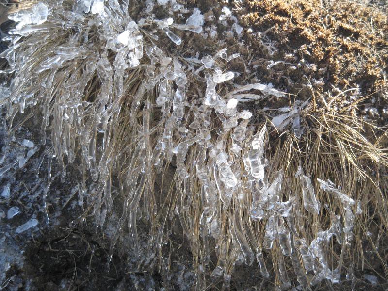
I've only ever done the crossing with the masses in summer, so found Mangtepopo road end eerily empty.  No full car park, nor steady shuttling of buses and large groups of tourists and walkers milling around.  Just us and maybe 5 other people.  Strangely, we all started with many layers of clothing, somewhat counter to our Naturist ideals.  Perhaps the biting wind and cool temperature had something to do with this.  We started off on the gentle walk through the Mangetepopo valley with ice all around.  Beautiful ice crystal formations grew out of the dirt like jewelled spines.  The grasses were covered in delicate ice casing.  A stream running beside the track formed sculpted shapes where the water splashed and trickled over rocks and down gullies.


At soda springs the grunt up the hill began.  We still had seen little or no sign of snow - only the chill in the gentle breeze told us it wasn't a pleasant summer's day. But when we topped out in the first crater, the white stuff made its presence known in the form of quite patchy snow and ice.  As the DOC office lady had predicted, the rain had washed snow into the crater and frozen.  I untied my ice axe, more in hope than necessity, but although things were a little slippery in places there was no thought of strapping on crampons.

In very little time we'd climbed the spur to the top crater.  The wind was fresh and chilling but the tops were sunny and quite pleasant.  We crossed and picked our way down the other side through the steep scoria.  No snow, no  ice, nothing but loose, sliding rubble.  We slowly and carefully descended to the emerald lakes.  Emerald in summer, icy white in winter!

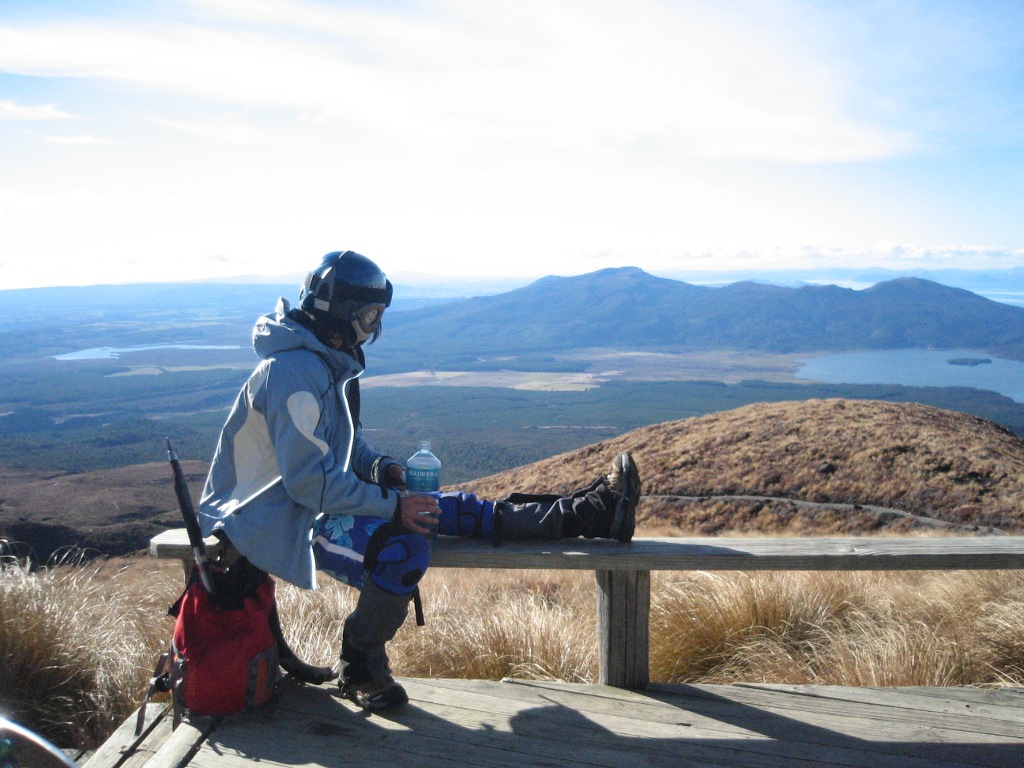
We lunched here in the shelter of a rocky outcrop, absorbing the sun like lizards.  A couple of us gingerly made our way onto the lake and tapped at the surface with ice axes.  The lakes seemed very solid - but we didn't push our luck.


We carried on through red crater, the third of the four big craters.  This was the snowiest part of the journey, with good cover over the entire floor and a slushy, icy exit to Blue Lake.  Blue Lake was truly spectacular as a large white expanse of ice.


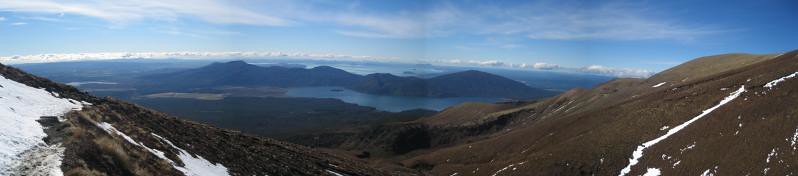
We sidled around the edge of the lake and began our descent, to spectacular views of Lake Rotoaira with Taupo in the background.


All too soon we left the snow behind, and ice and rock gave way to mud and gravel.  The track to Ketatahi Hut was showing a lot of damage with washouts and great pieces of wooden edge pulled loose and fallen down the hill.  I always find the descent to Ketatahi Hut interminably long and today was no exception - the track wound back and forth and the hut grew closer in agonisingly small increments.  But soon enough we were chomping on afternoon tea on the porch.


The interminable track carried on from the hut to the beech forest, which is a pleasant finale to the day.   Before long we were met by our driver with welcome cold drinks and were loaded into the car to return to the lodge, to hear excited stories about a great day in the snow.

I'm happy I've done Tongariro Crossing in the winter.  In the event it was pretty well like a summer crossing - we didn't need to utilise our snowcraft skills at all.  But it was superb to experience the crossing like it must have been before the rest of the world discovered it - peaceful, tranquil and deserted.  Tongariro feels like an otherworldly place so much more when it's not scattered with other walkers.

Of course, 10 days later Tongariro did its thing.  Returning two weekends later for a Whakapapa Ski weekend (and the second Family Trampers weekend) the sour smell of sulphur was in the air and clouds hung dark and foreboding over Tongariro and Ngaruhoe. It's quite special to think that we were one of the last people to cross Tongariro for probably quite some time.

If you have done the snowcraft course and know what to do with crampons and ice axe, The Crossing in Winter is definitely a trip to do.  You're still on a well formed track so even with more snow and ice, it should be pretty good going, the scoria descent possibly the only tricky bit.  Definitely a good side trip if you are on the mountain but want a break from Whakapapa.

And the future of WANG?  Well, it has its detractors, with their "hypothermia waiting to happen" this and "sunburn in terribly sensitive places" that.  Any innovation always has haters.  So if you have been seeking clothes-optional trips above the snowline, you now need look no further...

Photos:
http://www.flickr.com/photos/girl_geek/sets/72157630834565798/
https://picasaweb.google.com/108814469832492095035/Snow2012?authkey=Gv1sRgCJbegK6AoYXUowE

Sunday, May 6, 2012

Papatahi Crossing: Catchpool to Wairarapa


I've always wondered about that lonely meandering track from the Orongorongo valley, that finishes in the unfashionable backwaters of the South-West Wairarapa.  And I see that Kate Cushing must feel that way too, since she's leading a trip here on 29 June. Two of us took a look last month on the spur of the moment and it is well worth it.  Here's a sneak preview of why you should sign up for this trip.

When:
Saturday 5 May, Sunday 6 May 2012

Who:
Mike Gilbert and Andrew Bichan (scribe)

Weather:
Cloud at about 800m with light South-Easterlies both days.  Scattered showers predicted but none eventuating.

Access
See “Driving Instructions” below.

The trip starts as a Friday morning inkling.  The forecast is settled and at least one of us has always intended, but never quite got around to knocking off this Rimutaka Range crossing.

We leave Catchpool at 10am on Saturday and it is easy going over the Orongorongo track and up the river to Papatahi Hut (about 3hrs).  The hut is new and in fantastic condition but locked with bookings essential (link below).

From here, you need some map reading skills.  About a kilometre upstream from the hut the track heads up North Boulder creek then into the first tributary (true left) before launching itself up a steep 500m ridge climb (some kindly soul has left a rope in one particularly gruesome spot).  It eases for the last 100m before topping out at just over 900m.

The view expands as we climb until, just as we identify the Makara wind farm, we ascend into mist.  The mossy condition of the forest shows that the clouds scrape along these hills a fair proportion of the time.  We reach a small clearing with a survey pin at the top about 3pm and just manage to send a text to our driver.  We’re in cloud and it’s a bit chilly so we don’t stick around.  The track drops gently to about 700m then plummets to 300m, before easing us down to 200m.  The descent is fairly tricky in places; the track is not always easy to find and it’s loose or slippery underfoot. 

Wharepapa hut is on the other side of Wharepapa stream (true left) but sign posted: “Joe’s Hut.”  At 5pm it’s already quite dim and we light candles as soon as the door shuts.  The hut is well looked after and the log book indicates relatively light use with a lot of hunters.


The next morning we follow the track from the door of the hut (not quite what the map shows) about 140m up to a saddle which drops us into the Battery Stream catchment.  The track from here is fairly rough in places and easily lost but we don’t have too much trouble working our way out into gently shelving beech forest which fades away for a last 2km walk along a farm drainage ditch to the road; about 3hrs after leaving the hut.

All up it took us about 10 hours; we aren’t super fit and weren’t pushing it, but I suspect a bigger party will be slower.  Track conditions are variable and a little challenging in places.  I thoroughly enjoyed this impromptu trip; tested some new gear and didn’t waste the weekend mowing the lawns; definitely one for the bucket list.

Useful Information
Map:


DoC track description: 

Papatahi Hut: 

Wharepapa Hut:

Driving instructions
West end:  Catchpool stream off the Coast Road from Wainuiomata.
East end:  From Featherston, turn South onto the Western Lake Road (also the way to Cross Creek).  Follow this for ages until you leave the lake behind and see the “East West Access Road” coming in from your left.  About 2.5Km past this there is a barely visible pull off on the right with a faded DoC sign.  There is a farm entrance labelled “Devon” about 200m earlier.  If you go around a sharpish right bend and a bridge you have gone 500m too far.

Cellphone coverage
Mostly none.  Some patchy cover at the top of Papatahi; intermittent coming down to the farm land and at Western Lake Road.  I wouldn’t rely on it.